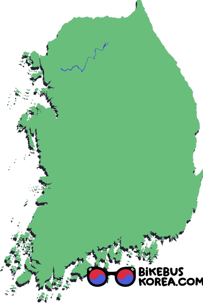
Wend your way through the towering mountain valleys and wild expanses of inland Gangwon Province. The North Han River (Bukhangang) connects Seoul with Chuncheon, a city of 300,000 residents, famous for dakgalbi barbecue chicken.
Jump to transportation / accommodation / navigation
our guide to cycling and route certification in Korea
Our Cycling difficulty Rating


1/5
mostly flat: see below
1/5
70 to 115km
Quick Clarification
There are three connected river paths all called Han, which may all be referred to using English or Korean names.
We use Han River (Korean: Hangang) to refer to the waterway and cycle path between Neungnae Station and the Yellow Sea. This river is fed by two major rivers: the South Han River (Korean: Namhangang) and the North Han River (Korean: Bukhangang), which meet at the dumulmori near Neungnae Station.
Han River may also refer to the South Han River and Han River together.
We aim to reduce confusion here by sticking to the English names, but it may save you some confusion if you become familiar with Hangang, Bukhangang and Namhangang.
How to Cycle from Seoul to Chuncheon
The North Han River path itself covers 70km between Chuncheon City and the confluence of the North and South Han Rivers. You can combine it with part of the Han River to connect with central Seoul.
It’s 20km from the Eastern edge of Seoul to the confluence, or 50km from the Western Yeouido Certification Centre.
Elevation Profile
Expand for a List of Certification Centres
Han River Path (through Seoul)
North Han River Path
Urban Areas and Transportation
Below is a map showing urban areas where you can find accommodation and supplies as well as bus connection information.
It is possible to bring a bicycle on intercity buses, so you can use this information to plan your cycling route.
see our guide to intercity bus travel in Korea
Expand for a List of Certification Centres
Han River Path (through Seoul)
North Han River Path
Expand for names and links to bus terminals
Cheongpyeong 청평터미널 (to East Seoul)
Gapyeong 가평터미널 (to East Seoul)
Chuncheon 춘천시외버스터미널 (to Seoul Gyeongbu, East Seoul, Busan Dongbu, Sokcho, other major cities)
Accommodation
If you are cycling from Yeouido or central Seoul to Chuncheon, you may want to break the 120km journey into two.
The halfway point is in rural Gangwon Province, so you can only split the route perfectly if you’re camping.
If you prefer to stay in motels, you can do a 75km and a 45km day with a stop in Cheongpyeong, or a 50km and a 70km day stopping in Yangsu.
Cheongpyeong has more options for motels than Yangsu.
Although Gapyeong is only 30km from Chuncheon, it’s an attraction in its own right and has a lot of accommodation options. This might be the most comfortable place to stop.
You could also sleep in Eastern Seoul or Hanam City which would put you 85-100km from Chuncheon.
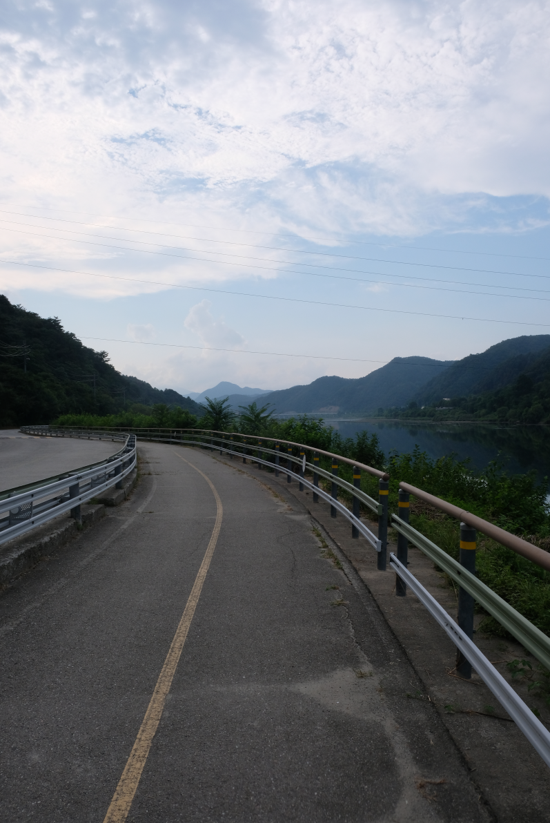
Navigation
Like the other major cycle routes in Korea, the Han and North Han River paths are well signposted. We recommend using the signs in conjunction with GPS. If the signs disagree with Naver Maps, Naver is likely to take you a more direct road with heavier traffic.
Some routes of Korea’s national cycle network overlap, meaning that you will see similar signs pointing in different directions. This happens near Neungnae, where there is a choice between the North Han and South Han Rivers. At this point it’s best to keep a closer eye on digital navigation and get a working knowledge of hangeul to help read the signs.
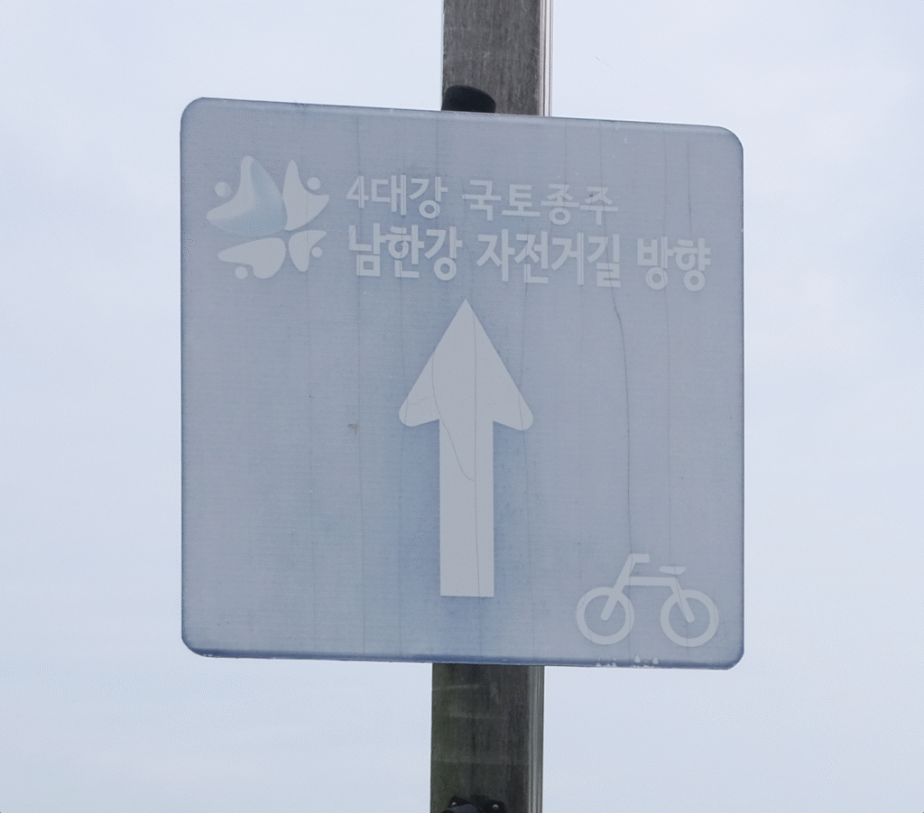
This is an example of the 4 Rivers signpost, which you will see along the Han River. Keep an eye out for the four-petal flower and the number 4 in the top left if you can’t read Korean.
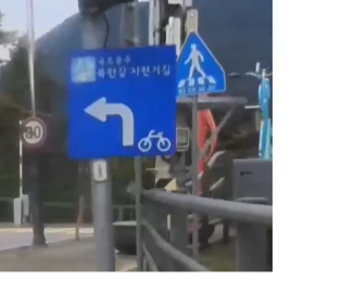
The North Han River Signs are very similar. The second line of text reads: 북한강 자전거길, buk.han.gang.ja.jeon.go.gil, North Han River Bicycle Road.
click to see our overview of national cycling routes
Still need help?
Get in touch for personal advice and support here.